

Verlauf des Rundwanderweges
Die kurze Tour des Rundwanderweges W7 verläuft mit 2,1km Länge vom Wanderparkplatz „Kalte Hofstube“ zunächst am Waldrand nach Süden und führt nach etwa einem halben Kilometer in das Waldgebiet Breitenhorn.
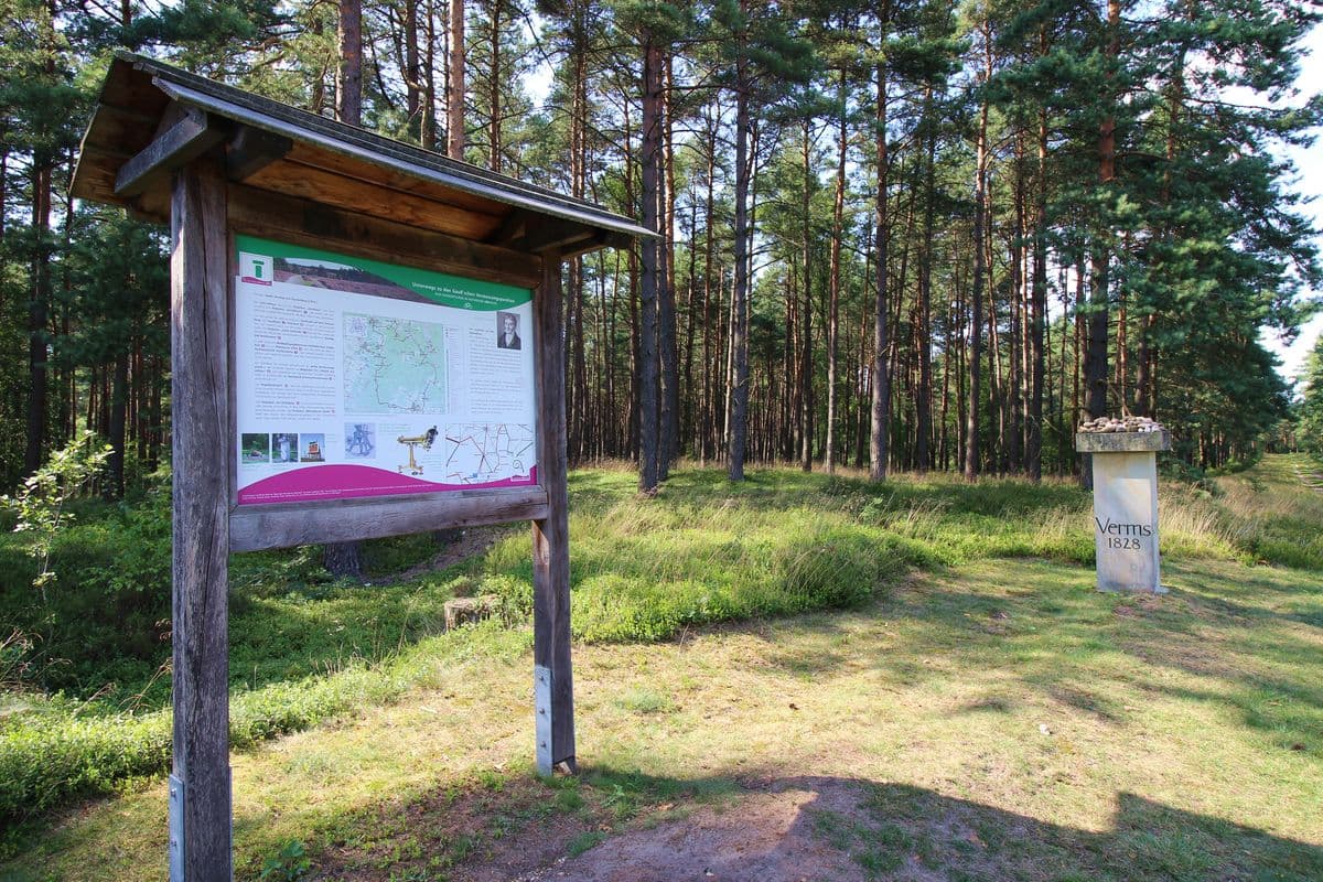
Nach weiteren 400 m zweigt ein Stichweg zum Gaußstein ab. Dieser Waldteil hat den Flurnamen Lutterloher Heide, was darauf hinweist, dass früher an dieser Stelle ausgedehnte Heideflächen vorhanden waren. Zurück zum Wanderweg geht es bald Richtung Norden bis zum Ausgangspunkt zurück.
Die kurze Tour ist nebem dem abgebildeten Piktogramm mit einem kleinen grünen Kreis gekennzeichnet.
Die Wanderung führt teils auf schmalen Waldwegen und sandigen Pfaden entlang weitläufiger Heideflächen und mit leichter Steigung hinauf auf die Hügelgipfel.
Ausgangspunkt
Der Ausgangspunkt für diese drei Wanderungen ist der Parkplatz "Kalte Hofstube" bei Neulutterloh.
Anfahrt zum Parkplatz „Kalte Hofstube”
Der Parkplatz „Kalte Hofstube” befindet sich an der K 17 von Unterlüß aus in Richtung Hermannsburg ca. 2 km vor Neu Lutterloh auf der rechten Seite am Waldrand.
Position: N 52° 49.85830', E 010° 15.63409'
Der Parkplatz „Kalte Hofstube“ ist auch erreichbar mit dem örtl. Beförderungsunternehmen CeBus 260 und dem Bürgerbus Südheide aus Richtung Hermannsburg und Unterlüß. Sie gehen dann Richtung Unterlüß ca. 9 Min. (750m).
Ausstattung: Sitzgruppe, Bank, Fahrradbügel
Weitere Informationen und Tipps zu den Touren des Wanderparadieses Südheide finden Sie auch im Region Celle Navigator.
Das dürfte Sie interessieren
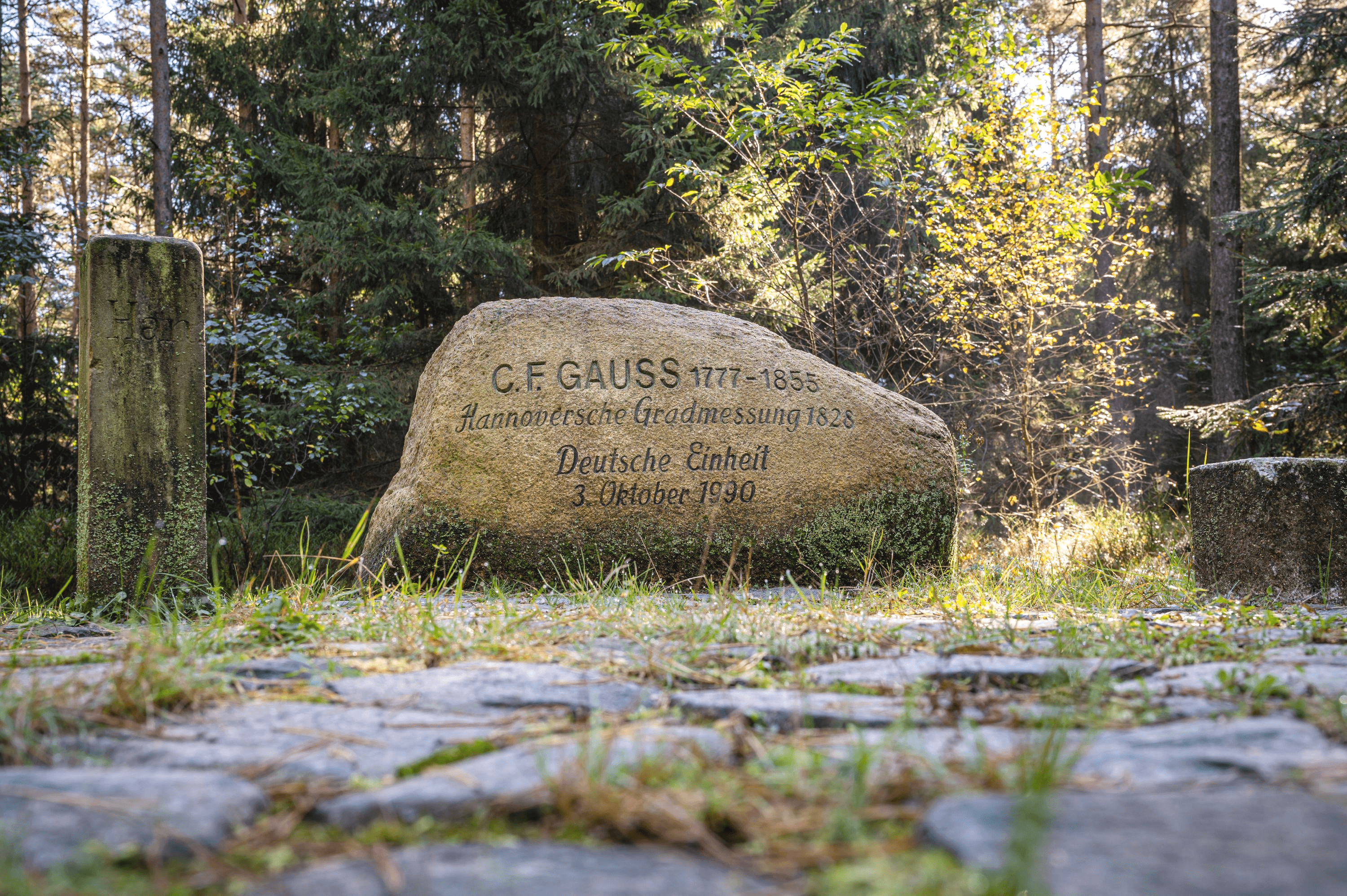
Gauß'sche Vermessungspunkte im Bergland der Südheide (Rundwege 2,1km, 8,6km, 18,6km)
UnterlüßDie Wanderung W7 "Gauß'sche Vermessungspunkte im Bergland der Südheide" folgt den Spuren des berühmten Göttinger Mathematikers und Landvermessers Johann Carl Friedrich Gauss. Er nutzte im 19. Jahrhundert die Anhöhen der Südheide für seine Vermessungsarbeiten und an seine Leistungen erinnern zwei Ge…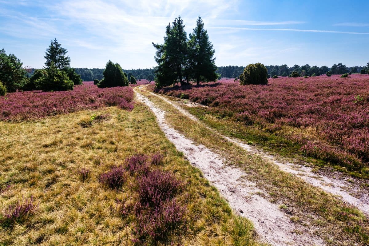
Mittlere Tour (8,6 km) Gauß’sche Vermessungspunkte im Bergland der Südheide
UnterlüßVerlauf des Rundwanderweges Die mittlere Tour des Rundwanderweges W7 mit 8,6km Länge führt ebenfalls vom Wanderparkpla...